
The May 2024 mud flood came off Marapi in West Sumatra, not Merapi in Java — two different volcanoes, two different warning chains. Neither runs on a predictive model: the real defence is geophones, rain gauges, cameras and rainfall thresholds, buying minutes rather than hours. Understanding why machine learning hasn’t yet entered this link in the chain says a lot about where prediction works and where it doesn’t.
On the night of 11 May 2024, the water arrived before the sirens. From Marapi — a 2,891-metre volcano in West Sumatra, Indonesia — heavy rain flushed the loose eruptive deposits off its flanks: banjir lahar dingin, «cold lahar flood», mixed with flash flooding. It hit Agam, Tanah Datar, Padang Panjang, Padang Pariaman and Padang. Indonesia’s national disaster agency, BNPB, reported 67 dead and 20 missing as of 16 May; on 14 May the count had been 50 dead, 27 missing, 37 injured, 3,396 displaced; by 29 May the Pusdalops operations centre listed 63 and 10. The figures don’t reconcile, and that itself is information: in an event like this, the accounting settles over weeks.
Since that night a particular version of the story has circulated internationally, and it’s worth taking apart piece by piece, because it says more about us than about Indonesia. It goes like this: after Sumatra, the Indonesian government deployed a predictive model — often implicitly a machine learning one — able to forecast lahars on Merapi, Java’s most closely watched volcano, and warn the villages below. It is wrong in three separate places, and the three together explain why artificial intelligence, at this specific link in the chain, isn’t there yet.
First: Marapi and Merapi are two volcanoes
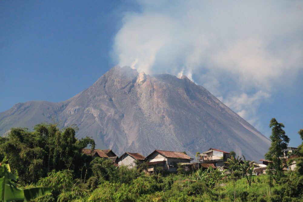
They differ by one vowel and about thirteen hundred kilometres of sea. Marapi is in West Sumatra; Merapi sits in Central Java, above Yogyakarta. The confusion isn’t harmless, because it drags an institutional confusion with it. Merapi is monitored day to day by BPPTKG, the geological hazard mitigation technology research centre based in Yogyakarta. PVMBG, the national volcanology centre, and BPPTKG both sit under the Geological Agency of the energy ministry, but they are not the same body. Everything done after May 2024 was done by BNPB and BMKG — the meteorological agency — on Marapi. No source documents any link between the Sumatra disaster and new investment on Merapi.
Second: a lahar is not an eruption
This is the technical point that changes everything. On Merapi as on Marapi, lahars are overwhelmingly secondary phenomena: intense rain falls on loose pyroclastic deposits left by an eruption, sometimes years earlier, saturates them and sets them moving down the channels. Merapi’s 2010 eruption expelled at least 130 million cubic metres of material, much of it funnelled into the Kali Gendol, and more than a hundred lahar events followed in subsequent years. On Marapi, in June 2024, geologists still estimated some 700,000 cubic metres of material sitting on the summit and flanks: ammunition already loaded, waiting for a meteorological trigger.
Forecasting an eruption and forecasting a lahar are different problems. The first has long precursors — seismicity, ground deformation, gas chemistry — with a vast literature behind it, and automatic classifiers of seismic signals are genuinely being trialled there. The second has essentially one precursor: how much it rains, where, and for how long, on a surface whose available sediment changes after every event.
Third: what exists is detection, not prediction
After 2010, BPPTKG installed lahar monitoring stations along Merapi’s rivers, built around geophones and IP cameras. A geophone is a vibration sensor: a moving lahar generates a continuous, broadband seismic rumble, recognisable and distinct from an earthquake. When recorded energy crosses a threshold, the station transmits; the camera confirms visually that it really is a flow, not a truck, a thunderstorm or a minor slump. This is a detection system. It sees the lahar once the lahar has already started. The lead time it gives houses downstream is measured in minutes, not hours, and depends on how far they are from the sensor.
Alongside the geophones sit rain gauges and rainfall thresholds. In December 2024 BPPTKG cited 20–60 mm per hour sustained for more than an hour as an indicative triggering range, with the stated intention of issuing notifications from above 10 mm in the first ten minutes, revising the assessment towards 60 mm/h. This is the part that most resembles a forecast, and it is an explicit numerical rule: two numbers and a time window. Not a trained model, not a neural network. No formal regulatory document setting it out has surfaced: it is an operating practice stated publicly by the agency.
What was actually done on Marapi
On 9 and 10 June 2024, BNPB began coordinating the installation of an «integrated» early warning system — weather, volcanic activity, sensors and sirens — on the rivers draining towards Tanah Datar, Agam and Padang Panjang. Suaidi, head of the BMKG geophysics station in Padang Panjang, identified 23 at-risk points needing coverage, with the alarm triggering self-evacuation managed by nagari communities, the traditional Minangkabau administrative units of West Sumatra. By 2025, six units had been installed by BNPB on four rivers rising on Marapi, and the provincial government had requested more. Twenty-three points deemed necessary, six delivered: the gap is the real story.
Where AI could fit — and why it doesn’t yet
A machine learning model would have an obvious job here: classify the geophone signal in real time to separate a lahar from everything else, cutting the false alarms that erode community trust in sirens. That is a seismic time-series classification problem, technically within reach. A second job would be more ambitious: estimate, from weather radar and an updated map of deposits, the probability that a given catchment produces a flow in the next few hours. There is no evidence that such systems are operational in Indonesia’s lahar warning chain, and it would be careless to assume they are.
The reasons are instructive, though. A classifier needs labelled events: a volcano produces dozens of lahars a year, not millions, and every eruption rewrites the catchment geometry, making older data stale. A probabilistic model needs a variable — available sediment — measured by field survey and drone, not by a continuous sensor. And above all: a system that detects with certainty and without training, like a thresholded geophone, is easier to defend in front of a community than a probability is. Whoever sounds the siren has to be able to explain why.
The number that sets the scale
Around 1.8 million people live on Merapi’s flanks, with an average density of 764 inhabitants per square kilometre within ten kilometres of the summit. It is one of the most densely populated volcanoes on Earth. In that setting, gaining five minutes of warning is not an engineering detail: it is the difference between crossing a bridge and not crossing it.
Which is where the story inverts the way it is usually told. The last mile of lahar warning in Indonesia is not algorithmic: it is a siren, a local radio station, a village head, a nagari community that decided in advance where people go and by which road. Artificial intelligence, if and when it arrives, will not replace that mile. At best it will make the signal that sets it in motion more reliable — and in a system where the final call is made by a human being with four minutes to spare, cutting false alarms is worth more than any long-range forecast.